Tropical Storms and Typhoons that originate within the Philippine Area of Responsibility ("PAR") or are likely to affect the Philippines will be shown on the image below. If you are sailing in the Philippines or planning to arrive here soon then we encourage you to stay current on the weather advisories. We suggest that you bookmark this page.
Current Storm Development
A Tropical Storm, Francisco / Mekkhala (07W), is now East of Taiwan, and is forecast to track Northwest. Tropical Storm Francisco / Mekkhalla will exit the PAR within today, and is currently unlikely to cross land.
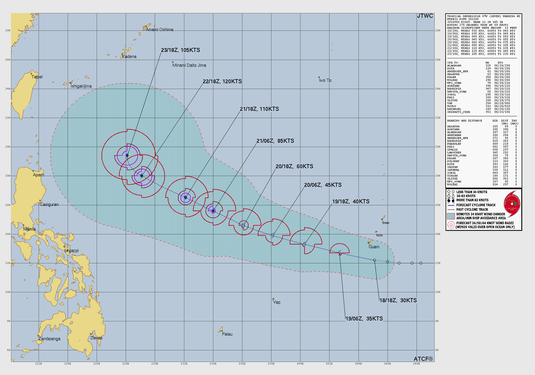
Tropical Storm Francisco / Mekkhala (07W)
At 2.00PM Tropical Storm Francisco / 07W Mekkhala was located at 24.8N 126.0E, approximately 235 NM East of Taipei, Taiwan, it is forecast to continue to track Northeast in the direction of South-west Japan, and will continue to weaken. If you are approaching the Philippines from the North then you should monitor this storm's progress. This will be the last notice for this storm
The above image is reproduced from Joint Typhoon Warning Center
To see how Tropical Storm Francisco / Mekkhala (07W) may affect your location of interest you can review the PAGASA Tropical Cyclone Advisory and see if there is a Tropical Cyclone Wind Signal in effect that affects that location.
Otherwise the Philippines is currently generally under the influence of the "Habagat" / Southwest Monsoon (Summer) so winds are frequently stronger and occasional local thunderstorms are likely; because of the increased frequency of rain showers, air temperatures are generally a degree or two cooler.
To view High Seas and Offshore Waters Forecasts for the Philippines you can review the PAGASA website and see if there is any local weather that may affect your planned adventures.
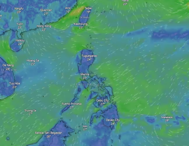
The Bigger Picture
For the current broader view of how forecast tropical weather in general may affect the Philippines we have included a graphic image from windy.com - if you click on the image you can see the forecast wind predictions for the coming seven days, and more . . .